El-Tarif Necropolis

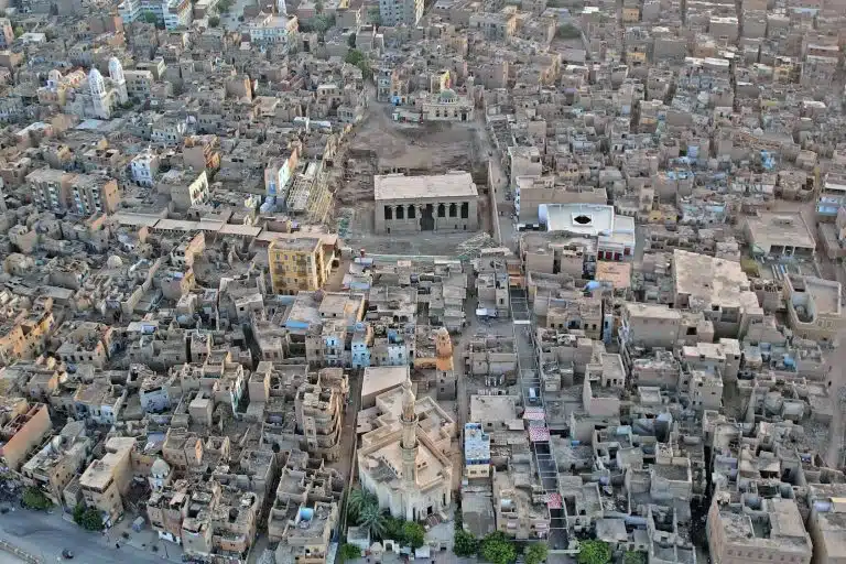
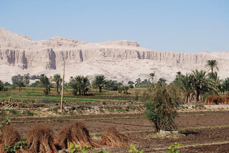
El-Tarif is a prehistoric site located at the base of the Theban cliffs on the west bank of the Nile, approximately 5 km north of Sheikh Abd el-Gurna. Long recognized as a section of an Old and Middle Kingdom Theban cemetery, it has also been recognized as a significant Predynastic site since the 1970s. El-Tarif is the area to the north of the road, which is itself north of Seti I temple, and the area of the Nobles Tombs and those of Dra Abu al-Naga which housed the hillside communities. Tarif is part of the administrative district of Qurna. It is a large area of flattish land with a number of huge three-sided saff tombs (tombs with a row of entrances) and hundreds of other tombs of various sizes.
The location was initially noted in the years 1826–1830 and is shown on the map created by Scottish adventurer and collector Robert Hay and English Egyptologist Sir John Gardner Wilkinson. After being studied by Flinders Petrie and Ernesto Schiaparelli, two Italian Egyptologists, in 1908–1909, it was eventually covered by the modern settlement of el-Tarif. Dieter Arnold (1970–4) resumed the site’s exploration, while Bolesltaw Ginter, Janusz Koztlowski, and Joachim Sliwa, a Polish team, later looked into the site’s Predynastic evidence (1978–82). El-Tarif’s cemetery is enormous. Its approximate dimensions are 1200 meters north-south by 600 meters east-west, or what Petrie referred to as cemeteries “A” and “B.” Petrie claims that these graves are from the 11th and 12th Dynasties, although it’s unclear where they are really located. Arnold referred to the burials of the first three kings of the 11th Dynasty as the “saff (row) tombs,” and they accounted for the most of the cemetery’s significance. The region between two 4th Dynasty tombs (mastabas) that Arnold dug up has the best archaeological stratigraphy. The two mastabas were constructed on younger gravel pediment sediments, which made up the bedrock in that location.
Stone artifacts from the Late Paleolithic were found near the top of the gravel pediment. There are connections between this stone tool manufacturing and the Late Paleolithic units (like the Qadan) of Nubia. The younger gravel pediment’s sediments are covered with a soil that was created by eolian activity. This soil includes stone tools that date to the early Holocene and are currently referred to as “Tarifian.” During the methodical excavation of the space between the two mastabas, a fireplace and over 3,200 flint objects were found to be concentrated around it. This is mostly a flakes-based stone tool business, with retouched flakes and unusual scrapers leading the way, followed by end-scrapers, perforators, and tools with denticulated notches. Microliths and burins are few.

The Post-Shamarkian, or Nubian, stone tool business is the most similar to the Tarifian industry. Along with the progressive disappearance of microliths and the emergence of Neolithic components like axes and bifacial tools constructed of cores, it is also marked by the formation of flakes. The concentration of Tarifian lithics also produced several dozen potsherds right next to the hearth. They are nearly totally devoid of ornamentation, however there are sporadic slanting imprints in a pattern. Forms include plates of a kind subsequently called “bread molds,” hemispherical bowls, and jars with cylindrical necks. The sherds fall into three categories in terms of technology: Three sherds of medium thickness vessels with mineral inclusions, straw tempered, polished surface, and fiber; one sherd of medium thickness with sand temper; two thin-walled sherds with sand temper. Despite the lack of biological remains in the Tarifian layer, the camp’s characteristics—such as its lack of habitation buildings and the lack of wear on its stone tools, which would have indicated that they were used as sickles—suggest a livelihood of hunting, gathering, and fishing.
Luxor Tours & Activities
Looking to save some costs on your travel? Why not join a shared group tour to explore Luxor, Egypt? Here are some activities you might be interested in:
Based on the information gathered from the sediments, it appears that the Tarifian formed during a dry era with eolian activity, most likely around the sixth millennium BC. Rain channels developed, linked to a Predynastic Nagada culture site from the fourth millennium BC, preceding another rainy occurrence. The first radiocarbon date (calibrated, about 5,200 BC) for the Tarifian site of MA 2/83 was acquired with the discovery of further Tarifian sites in the Theban area south of Qurna. With their microlithic and geometric stone tool industries, the surrounding Epipaleolithic societies are most likely the source of the Tarifian. Alongside its foraging economy, the Nile Valley produced the earliest pottery. Similar flakes-based stone tool manufacture was discovered at the Middle Egyptian site of Hamamieh in the trial trench’s lowest strata, along with ceramic artifacts that included Tarifian-style sherds and the distinctive Badarian rippling ware. A sterile layer made of sediments washed off the cliffside slopes was found above the Tarifian layer at El-Tarif.

The two houses at El-Tarif are the first examples of Predynastic Upper Egyptian stone foundation building that has been thoroughly recorded. The three stages of habitation that made up the Nagada culture layer at el-Tarif produced about 3,400 potsherds, the most of which (more than 80%) were of a ware with a lot of organic temper. This pottery most closely resembles the “rough brown” ceramics from the elKhattara sites in the Nagada region, which were excavated by Fekri Hassan and T.R. Hayes in the 1970s. El-Tarif sherds are primarily from grayish-brown, flat-bottomed pots and varied bowls with hole mouths; some have reddish-brown slips. Blacktopped (about 20 percent) and red-polished (about 10 percent) ceramics were less common. A collection of ceramics unique to this location had precisely positioned imprints in the forms of circles, triangles, or fish scales. Blade manufacturing is a defining feature of the extremely wealthy stone tool industry from the Nagada layer. Sickle blades with a rectangular shape are a new type of tool. As sickles, bifacial retouch tools were also employed. A few times, stone axes are chipped. This industry is generally distinct from other known assemblages of stone tools from the Nagada civilization. Plant remnants from the Nagada civilization were found in El-Tarif, including emmer wheat and barley grains. However, the faunal remains, which included domesticated sheep and goats, were not well preserved. The Nagadan layer’s hearth produced a (calibrated) radiocarbon date of 3,715 BC. When pieces of the Nagada culture pottery from this site were dated in the 1970s using thermoluminescence, an additional dating method, the results showed somewhat earlier dates of 3,810 BC and 4,340 BC.
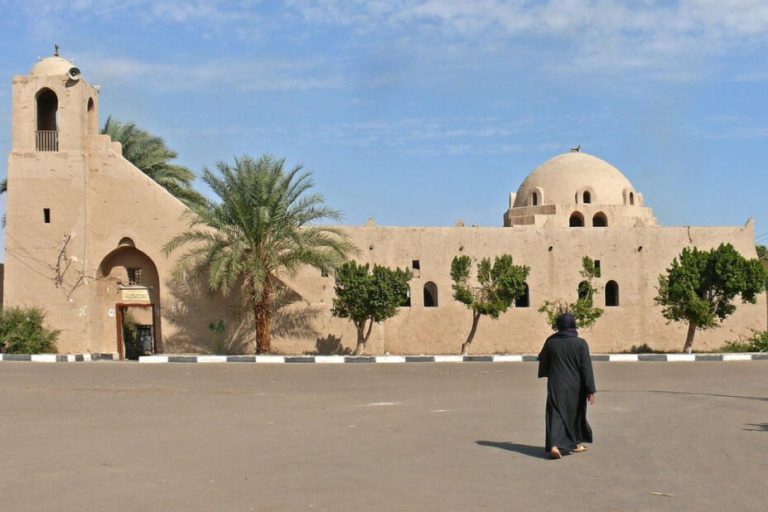
El-Tarif, saff-tombs
During the First Intermediate Period, a significant provincial tomb form called “saff-tombs” emerged regionally in the Theban region, and its monumental manifestation was discovered in the tombs of the Theban rulers of the early 11th Dynasty. This kind of tomb has a spacious court and relatively tiny internal chambers; it most likely sprang from older forms constructed in the late Old Kingdom. The primary feature of the saff-tomb is a row or two of pillars that are carved out of the firm gravel at the back of the courts.

The row of apertures between the pillars—which have been mistaken for entrances to distinct, aligned burial chambers—is referred to by the Arabic word “saff,” which means “row.” This kind of tomb is only found at the Theban site of el-Tarif, a vast cemetery that extends in the low desert northeast of Seti I’s mortuary temple and directly across from the temple of Karnak on the west bank of the Nile, with a few notable exceptions (like the tombs of Intefiker and Intef at Dendera).

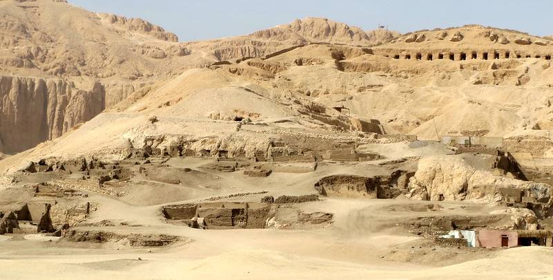
The cemetery is around 1.2 km in length from north to south and 0.6 km in length from east to west. It is thought to include 300–400 saff-tombs. There has never been a systematic investigation of the el-Tarif cemetery. Auguste Mariette, Gaston Maspero, and Georges Daressy conducted many sondages between 1860 and 1889, during which they discovered fragments of a stela (CG 20512) belonging to the Theban monarch Wahankh Intef II. While excavating some of the lesser tombs in 1908–1909, Flinders Petrie left out the royal tombs from his report. Dieter Arnold carried out methodical excavations in the royal tombs between 1966 and 1974, which offered fresh perspectives on their layout, structure, and order. Furthermore, a 1:1000 scale survey map of the whole cemetery was created, which included every saff-tomb that could be seen from the ground.

Three imposing royal tombs, referred to locally as Saff el-Dawaba, Saff el-Kisasija, and Saff el-Baqar (or “Ssaft-el-leben” on early maps), are the focal point of the cemetery. The 100–300 m long and 65–80 m wide tomb courts were first protected by mudbrick walls and were buried 5 m below the surface of the low desert by piles of excavated gravel. The front portion of these courts appears to have remained open, with the exception of the Saff elKisasija, where the remnants of a wall and chapel-like mudbrick building were discovered near the eastern end. The real front of the tombs are formed by two rows of twenty to twenty-four pillars that are chiseled out of the firm gravel at the back of the courts. The royal cult chamber, which has two pillars supporting the ceiling, is accessible by a brief, narrow hallway behind the pillars in the center of the rear wall. The burial chamber, where the king was interred in a stone sarcophagus, is accessible from the ritual chamber via either a vertical shaft or a sloping corridor. There are smaller, more similar-plan hallways and rooms carved in the back wall on each side of the royal chambers and along the court’s side walls that functioned as royal family members’ and other courtiers’ graves.

Though the walls appear to have been plastered, the tiny passageways and chambers of the saff-tombs likely remained empty save for a few minor stelae. The Saff el-Baqar had more ornate furnishings, with limestone lining the walls and slabs of sandstone covering the floor of the central hallway. The pyramids that Mariette and others theorized were connected to the royal tombs of el-Tarif have not been confirmed. This tomb belongs to Wahankh Intef II, based on remnants of a stela (CG 20512) discovered at the eastern end of the Saff el-Kisasija chapel. The monarch and his five named dogs are shown in carvings on the stela. The owners of the other two royal tombs were not mentioned in any written records, but archeological data indicated that the Saff el-Dawaba was the oldest of the group and the Saff el-Baqar was constructed later than the Saff el-Kisasija. The Saff el-Dawaba has been ascribed to Sehertawi Intef I and the Saff el-Baqar to Nakhtnebtepnefer Intef III based on this sequence. Since the private tombs have never been thoroughly investigated, little much is known about them. Though far smaller than the royal monuments, they are of the same kind. There are two groupings, according to the assessment of the accessible tombs. The cult chamber roof in a likely older series of tombs is supported by just one pillar, although subsequent tombs appear to have two pillars. Taken off their stelae and otherwise bare, their owners are lost to history.
Did you know that
By purchasing through our links, you support us at no additional cost.
Thank you for your support. ♥️