

From the summit of the Theban hills, Luxor resolves into three bands of color: the tan-gold of desert running to the horizon on both sides, a narrow ribbon of intense green hugging the river, and the thread of the Nile itself, cutting through the middle. The temples and tombs that draw millions of visitors each year sit inside that green ribbon, or are carved into the desert cliffs that frame it — but they were never separate from it. The priests of Karnak, the artisans who cut the royal tombs, the officials who administered the harvest, all lived inside the same narrow strip of cultivated land that still supports Luxor’s population today.
That geography is easy to miss from ground level, where temple gates and hotel walls can make the monuments feel like isolated set pieces. It’s unmistakable from the air, or from any high point on the West Bank: ancient Thebes was built inside a working agricultural landscape, and a great deal of that landscape survives — still farmed, still inhabited, still shaping how the modern city functions. Understanding the Luxor countryside means understanding that the monuments and the farmland were never two different places. They’re two layers of the same one.
What Is the Luxor Countryside?
“Luxor countryside” isn’t an official designation — it’s a useful shorthand for the agricultural and village landscape that surrounds the city’s monuments and hotel districts, as distinct from the urban core of Luxor itself. Geographically, it sits inside the Nile Valley of Upper Egypt: a cultivated strip that, depending on where you measure it, runs from under a kilometer to several kilometers wide, flanked on both sides by desert that begins abruptly where irrigation stops.
Luxor spans both banks of the Nile, and the two sides function differently. The East Bank holds the urban center — Luxor Temple, the Karnak complex, the train station, the airport, most hotels, restaurants, and the bulk of the resident population and city infrastructure. The East Bank was, in ancient Egyptian cosmology, associated with the rising sun and the world of the living. The West Bank, by contrast, was linked to the setting sun and the afterlife: it holds the Theban Necropolis — the Valley of the Kings, the Valley of the Queens, the great mortuary temples — cut into or built against the desert cliffs. But the West Bank is not only a necropolis. Between the river and the cliffs lies a belt of farmland and villages that has supported agricultural communities for generations, and it’s this belt — on both banks, but especially the West Bank — that constitutes most of what people mean by the Luxor countryside.
Where the City Ends and the Countryside Begins
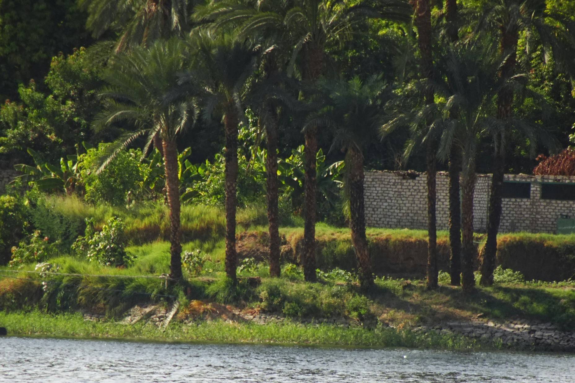
The shift from town to countryside happens quickly and is easy to notice, especially on the West Bank. Paved streets give way to narrower agricultural roads running along the tops of irrigation canals. Concrete buildings thin out and mud-brick and breeze-block houses take over, often clustered along the road in loose village formations rather than a dense street grid. Sugarcane and banana fronds start to crowd the roadside, and date palms — planted individually and in groves — punctuate the fields.
Water is the organizing structure of this transition. Irrigation canals, fed from the Nile, run in a network that determines where cultivation is possible and where it stops. Fields are typically small and divided among many families rather than consolidated into large holdings, a pattern rooted in Egypt’s long history of land distribution and inheritance. Beyond the last irrigated field, the change to desert is abrupt rather than gradual — there is no scrubland transition zone, just green, then sand, often within a few dozen meters.
The Landscape of Rural Luxor
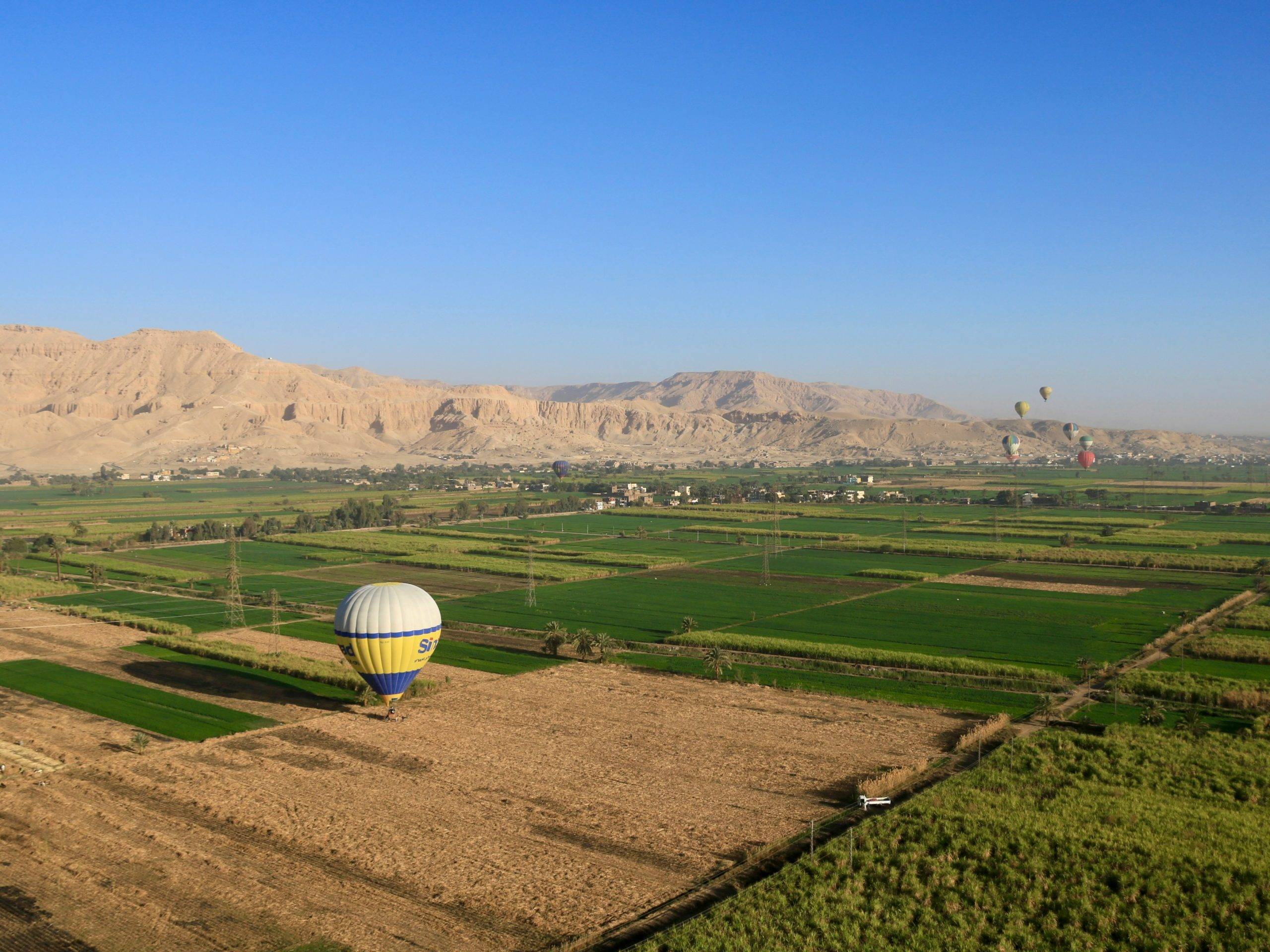
The physical landscape of rural Luxor is shaped almost entirely by two constants: the Nile’s water and the desert’s edge. Between them sits some of the most intensively farmed land in Egypt.
Sugarcane is the crop most visitors notice first, its tall green stands lining canal banks and roads across the West Bank in particular. Wheat, corn (maize), and berseem clover — grown as fodder for livestock — round out the staple field crops, rotated through the year according to the growing season. Date palms are scattered throughout, both cultivated commercially and grown individually near homes, valued for fruit, shade, and building material. Mango and banana cultivation is also present, particularly on the fertile silt of Nile islands, and smaller kitchen gardens around homes grow vegetables for household use.
Irrigation canals — some large enough to carry small boats, most narrow enough to step across — thread through the fields, carrying Nile water inland from the river. Behind the cultivated strip, the Theban hills rise sharply on the West Bank, their bare limestone cliffs a constant visual backdrop to the greenery below and the setting for the tombs cut into their flanks. The contrast between the two — intensely irrigated green fields and stark, uncultivated desert, often visible in the same frame — is one of the defining visual characteristics of the Nile Valley, and it has structured settlement and agriculture here for thousands of years.
Villages and Community Life
Rural Luxor is made up of numerous villages and hamlets threaded along the river and the agricultural roads, most of them built from mud brick or simple concrete block, often plastered and sometimes painted. These are working communities, not stage sets: they have their own bakeries, small grocery shops, mosques, schools, coffeehouses, and informal markets, and the rhythms of daily life there follow agricultural and religious schedules rather than a tourism calendar.
Agriculture remains the organizing activity for many rural households, though it now sits alongside other work — small trade, crafts such as alabaster carving (a long-standing specialty on the West Bank), construction, and tourism-related employment, which has become an increasingly important part of the local economy since Luxor’s monuments turned the region into one of Egypt’s primary destinations. Village markets, where they occur, tend to be small and functional rather than curated for visitors — places where produce, household goods, and staples are traded among residents.
It’s worth resisting the instinct to treat these villages as a single, uniform thing. They vary by location, by proximity to major sites, by the balance of farming versus tourism income, and by history — a history that, on parts of the West Bank, is unusually entangled with the ancient monuments themselves.

Rural Life on Luxor’s West Bank: Where Villages Meet the Necropolis
Nowhere is the coexistence of ancient heritage and modern rural life more direct — or more contested — than on Luxor’s West Bank, where villages have existed for generations on top of, and immediately around, the Theban Necropolis.
The clearest example is the area historically known as Qurna, a cluster of hamlets built into the hillside at Sheikh Abd el-Qurna, directly above and among the rock-cut Tombs of the Nobles. Accounts from early nineteenth-century travelers describe a community already living in this area, in some cases building homes that incorporated ancient tomb chambers as rooms or cellars. Egyptian antiquities authorities viewed this proximity as a serious problem: it blocked archaeological excavation, and some residents were documented looting tombs accessible from beneath their own houses. Efforts to relocate the community date back to the 1940s, when the Egyptian government commissioned architect Hassan Fathy to design a new settlement, New Qurna, built using traditional mud-brick techniques intended to be affordable, climate-appropriate, and culturally resonant — a project now studied internationally as a landmark of vernacular and sustainable architecture, even though the relocation itself was resisted by many residents at the time and only partially succeeded.
The fuller resettlement came decades later. Between 2006 and roughly 2010, Egyptian authorities carried out a larger and more forceful demolition of the remaining hamlets at Sheikh Abd el-Qurna and the neighboring area of el-Khokha, relocating several thousand families to newly built housing elsewhere. Officials described it as a long-overdue step to protect a UNESCO World Heritage site and enable proper archaeological work; for many of the families involved, it meant leaving homes, land, and a way of life their families had held for generations, in some cases against their wishes. Both things are part of the historical record, and it’s a useful case study in how “ancient heritage” and “modern rural life” aren’t always in easy harmony — sometimes they’re in direct, difficult tension over the same physical ground.
Today, visitors moving between the Valley of the Kings, the Tombs of the Nobles, and the mortuary temples of the West Bank are, whether they register it or not, moving through a landscape where this history is still visible — in the empty, partially demolished hillside above Sheikh Abd el-Qurna, in New Qurna’s distinctive mud-brick architecture, and in the ordinary agricultural villages that continue further out from the necropolis, largely unaffected by this history and still organized around farming rather than archaeology.

Agriculture and the Seasons of Luxor
Agriculture in the Luxor countryside is organized around a modern annual cycle rather than the ancient flood calendar (more on that distinction below). Broadly, autumn and winter (roughly October through February) are active planting and growing months for wheat and other staple crops, with mild temperatures supporting steady growth. Spring brings the sugarcane harvest into full swing and the first summer plantings begin. Summer (May through September) is the most demanding season climatically — daytime heat routinely passes 40°C (104°F) — but it’s also when some crops, including parts of the sugarcane cycle and certain vegetable rotations, are actively worked, meaning farm labor continues even through the harshest months. Because irrigation today is managed year-round rather than dictated by a single annual flood, exact planting and harvest windows vary by crop, by field, and by individual farmer’s rotation, rather than following one fixed regional calendar.
Sugar Cane and the Agricultural Economy of Upper Egypt
Sugarcane is the crop most closely associated with Upper Egypt’s agricultural economy, and Luxor sits within its main growing belt, alongside Qena, Sohag, Minya, and Aswan governorates. The government’s Sugar and Integrated Industries Company operates factories across these governorates, including one at Armant, a town on the Nile a short distance south of Luxor. In recent reported seasons, the Armant factory alone has processed over a million tons of cane annually, producing on the order of 100,000 tons of sugar and tens of thousands of tons of molasses — figures that fluctuate from year to year with crop yields and government purchasing targets.
The cane harvest is labor-intensive and highly seasonal, running roughly from December through May or June depending on the year and the factory. It’s a major source of seasonal employment across Upper Egypt: teams of day laborers cut the stalks by hand with scythes, load them onto trucks, and send them to the nearest factory, typically within a short distance of the fields since raw cane loses sugar content quickly after cutting. For many small farming families in the Luxor countryside, sugarcane functions as both food-adjacent income (through molasses and byproducts used locally) and a cash crop tied to a national industry — one that has faced real strain in recent years from payment delays and rising costs, issues that have occasionally spilled into labor disputes at factories including Armant.
The Nile and Rural Life
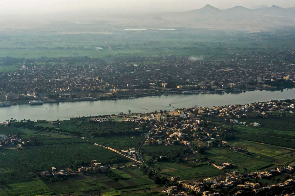
Nothing in the Luxor countryside exists independently of the Nile. It’s the source of the irrigation water that makes cultivation possible at all in what is otherwise a hyper-arid desert environment, and historically it was also the primary transport route connecting Luxor’s communities before roads and bridges made land travel dominant.
Fishing continues along the riverbanks and from small boats, feluccas among them, though it plays a smaller role in the local economy than agriculture. The felucca itself — a traditional wooden lateen-rigged sailboat — remains in everyday use for short local crossings and cargo as well as for the sunset tourist rides most visitors know it for. A short sail from the Luxor waterfront, particularly on the West Bank side, can reach small Nile islands such as Banana Island, a low, fertile strip of land given over largely to banana, mango, and guava cultivation — a vivid, close-up example of how completely the Nile’s silt supports agriculture even on land with no connection to the mainland.
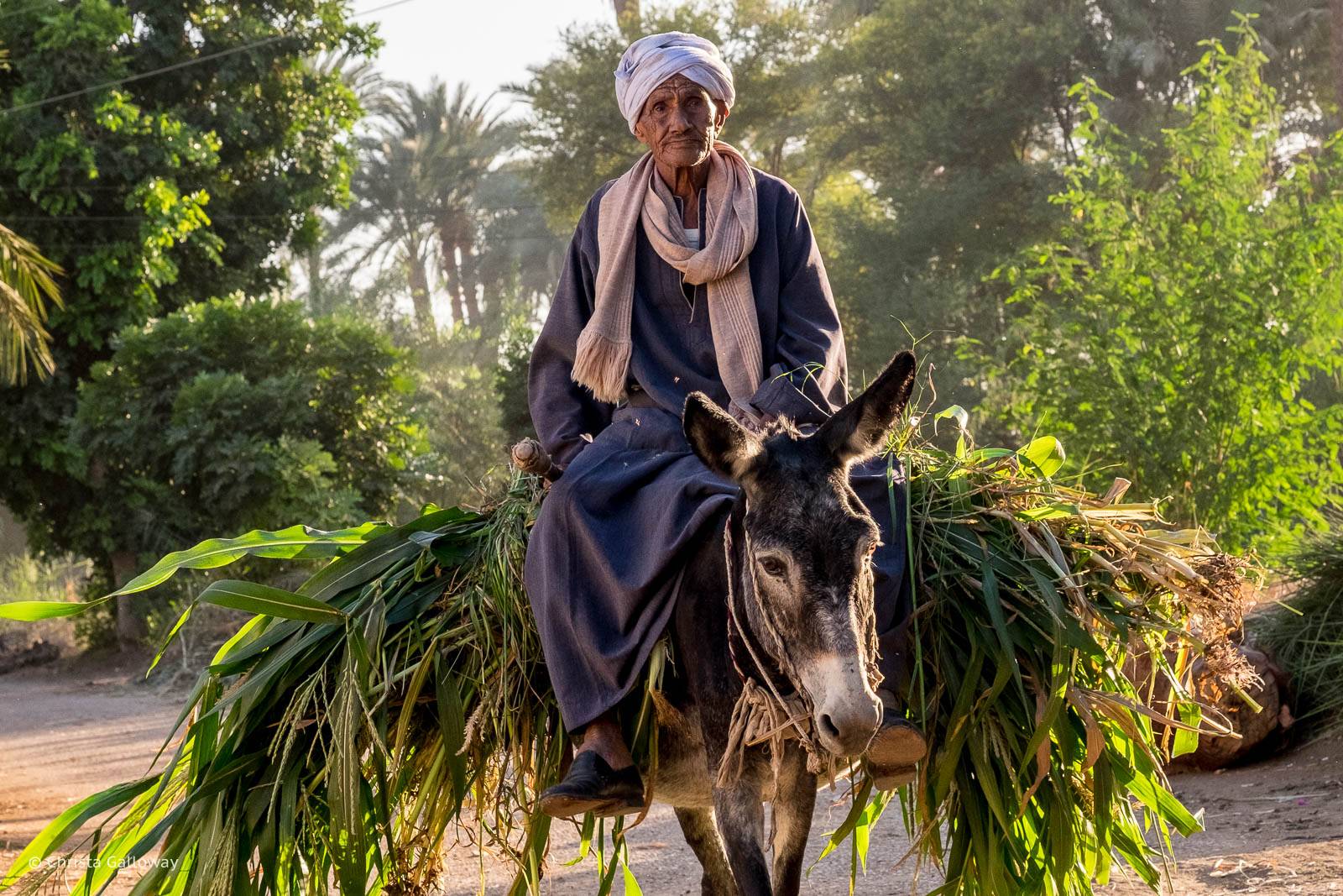
Livestock — water buffalo, cattle, goats, and donkeys — remain part of the rural economy too, grazed on berseem clover and other fodder crops and used for both dairy and traction on smaller plots where mechanization hasn’t fully replaced animal labor.
Food From the Luxor Countryside
Much of what’s eaten in and around Luxor traces a short distance back to these fields. Bread, a daily staple, is typically baked from wheat grown in the region or from flour milled nearby. Dates from local palms, seasonal vegetables from village plots and market gardens, and fruit from the mango, banana, and guava orchards common on the West Bank and the Nile islands make up much of the fresh produce sold in local markets. Dairy and eggs come largely from small-scale household livestock rather than industrial operations. None of this is unique to Luxor — it reflects a pattern common across the rural Nile Valley — but it does mean that a meal in a Luxor village, or produce bought at a local market, is genuinely connected to the fields visible just outside town, rather than shipped in from elsewhere.
Rural Luxor and Ancient Egyptian Agriculture
The connection between Luxor’s modern farmland and ancient Egyptian agriculture is real, but it’s a connection of underlying geography and general practice, not an unbroken tradition frozen in time.
Ancient Egyptian civil life was structured around three seasons tied directly to the Nile’s annual flood: Akhet, the inundation, when floodwaters covered the fields and direct farming stopped; Peret, the emergence, when the water receded and left behind a fresh layer of fertile black silt ready for plowing and sowing; and Shemu, the harvest, the hottest and driest part of the year, when grain was cut, threshed, and stored before the cycle began again. This flood-driven rhythm is vividly documented in the painted tombs of Luxor’s West Bank nobility. In the Tomb of Menna (TT69) and the neighboring Tomb of Nakht (TT52), both cut into the hillside at Sheikh Abd el-Qurna, wall paintings show the stages of the grain harvest, threshing and winnowing, grape harvesting and wine pressing, fishing, and fowling in the marshes — a detailed visual record of agricultural life more than three thousand years old, painted by officials whose jobs involved overseeing exactly these activities for the temple estates of Amun.
The single biggest break between that ancient system and the modern one came in 1970, with the completion of the Aswan High Dam roughly 200 kilometers south of Luxor. By impounding the Nile’s floodwaters in Lake Nasser and releasing them under human control, the dam ended the annual flood cycle that had governed Egyptian farming for millennia, replacing it with year-round, engineered irrigation. This made multiple growing seasons possible on the same land — a real agricultural benefit — but it also stopped the free annual delivery of nutrient-rich silt that had fertilized the fields for free, since virtually all of that sediment is now trapped behind the dam. Modern Luxor farmers rely on artificial fertilizer where their ancestors relied on the flood itself.
It’s also worth noting what wasn’t part of ancient Egyptian farming at all: sugarcane, the crop most associated with the region today, only arrived in Egypt following the Arab conquest in the seventh century CE, brought from further east. Ancient Egyptians sweetened food with honey, dates, and fruit syrups instead. The landscape looks continuous — green fields against the same desert cliffs, worked by families along the same river — but the crops, the water management, and much of the technology have changed substantially even where the underlying relationship between river, silt, and field has not.
Luxor Beyond the Monuments: The Living Landscape
It’s worth stating plainly what this whole picture adds up to: the temples, tombs, and museums that make up “tourist Luxor” do not exist in isolation. They sit inside, and were always dependent on, a working landscape of farms, canals, villages, markets, and religious life that predates them, outlasted the pharaohs who built them, and continues today under different economic and technological conditions.
This isn’t a claim that rural life around Luxor is unchanged since antiquity — it plainly isn’t, from sugarcane to engineered irrigation to mobile phones and tourism-based incomes. It’s a more specific claim: that the boundary between “archaeological site” and “living community” here is thinner and more entangled than a typical visit suggests, and that a fuller picture of Luxor includes both.
How Travelers Can Experience the Countryside
There are several reasonable, respectful ways for visitors to see this landscape without treating it, or the people living in it, as an attraction.
Cycling is one of the more immersive options, particularly on the West Bank, where flat agricultural roads connect villages, fields, and archaeological sites. It suits travelers who want a slower pace and are comfortable navigating unmarked rural roads, ideally with a rented bike from a reputable local shop and a basic route in mind. Morning hours, before the heat builds, are best — see our guide to seeing Luxor by bicycle for practical tips.
Walking through village edges and along canal-side paths works well for shorter stretches, especially combined with a stop at a site like the Tombs of the Nobles or a mortuary temple, but isn’t practical for covering long distances given the heat for much of the year.
Felucca trips put the river itself at the center of the experience — sailing past farmland, fishermen, and riverside villages, often with a stop at a Nile island such as Banana Island to see fruit cultivation up close.
Photography of the landscape itself is straightforward, but photographing people requires consent, discussed further below.
Farm visits and local food experiences, where genuinely and transparently arranged — through a reputable local guide or an operator with an established relationship to a specific family or business, rather than an improvised stop at a stranger’s field — can offer real insight into how agricultural households live and work. These should never be assumed to be open by default; farmland and homes in the countryside are private property and working livelihoods, not public exhibits.
A local guide adds real value for first-time visitors and photographers in particular, since they can navigate etiquette, language, and access in ways an independent traveler often can’t. Independent travelers with some Arabic or prior experience in rural Egypt may prefer cycling or walking on their own; families and slower travelers may prefer a guided felucca or walking route with fixed stops.
A Day in the Luxor Countryside
There’s no single correct way to spend a day in the countryside, and the right mix depends on season, access, and what a guide or operator can legitimately arrange. But as one illustrative example of how the pieces might fit together: an early start on the West Bank, before the heat sets in, cycling or walking along agricultural roads past sugarcane fields and irrigation canals; a stop for tea or a simple breakfast at a village bakery or small local shop; a midday visit to one or two of the Tombs of the Nobles to see the agricultural scenes described above, connecting the modern landscape outside to its ancient depiction on the tomb walls; an afternoon felucca sail, perhaps out to a Nile island, as the heat peaks and the river offers a breeze; and a return toward the West Bank as the light softens ahead of sunset, when the desert cliffs and the green fields below take on their most striking contrast. This is one possible shape for a day, not a fixed itinerary — actual timing and access depend heavily on the season, the specific villages or sites involved, and any local arrangements in place.
Responsible Countryside Tourism
The countryside around Luxor is home to working communities, not a backdrop, and a few consistent principles make for more respectful travel here:
- Ask before photographing people, and be especially mindful with children — a polite request, even through gesture, is standard practice and generally well received.
- Respect private property: farmland, homes, and workshops are livelihoods, not open attractions, and entering without an invitation isn’t appropriate.
- Dress modestly, more so than you might in central Luxor’s hotel districts.
- Be mindful around religious spaces and prayer times.
- Avoid disrupting agricultural work in progress.
- Be cautious of informal “village tour” arrangements that treat residents primarily as something to be viewed rather than as people going about their lives — a guide with a genuine, transparent local relationship is a better route than an improvised stop.
- Support legitimate local businesses — bakeries, market stalls, workshops — rather than giving cash or gifts directly to children, a practice that, however well-intentioned, tends to encourage begging over time rather than genuinely helping.
Best Time to Explore the Luxor Countryside
October through April offers the most comfortable conditions for time outdoors, with the shoulder months of October–November and March–April striking the best balance between mild temperatures and manageable visitor numbers; December through February is cooler still but busier and pricier. May through September brings serious heat, regularly exceeding 40°C (104°F) by midday, which makes early morning or late afternoon the only realistic windows for cycling, walking, or extended time in the fields — though it’s also when much of the sugarcane harvest and other agricultural work is actively underway, for those specifically interested in seeing farm labor in progress.